The Story: Big Spring

  Author’s note: To get the most out of this story, I recommend you first read the previous blog about the place. Thanks!

Tiri was a born traveler. Unlike others content to live out their lives on rocks at the edge of a dark watery world in the company of a few fellow creatures, Tiri wanted to follow the water to wherever it led. She knew the water moved. It passed over her body in a gentle flow, always in the same direction. Why only one way? Why never back and forth? And where was it going? Were there worlds out there different from her own? Tiri had to find out.

Like all her fellow creatures, Tiri had a long, lithe physique, off-white skin, vestigial eyes that distinguished only light and dark, holes for ears, a filter for a mouth, and dozens of feet—the perfect body for her world. She needed only two elements to survive—air to breathe and water to keep her skin moist and to provide nourishment. An easy, monotonous life, but there were dangers: the elders told cautionary tales of those who had crept too close to the edge of the rocks and vanished into the watery depths, where, unable to breathe, they met a quick death.

Thus, if Tiri wanted to travel, she needed a floating device that would keep her above the water. It seemed a flat rock would do, but when she finally dislodged a small piece, it immediately kerplunked beneath the surface. From time to time, bits of debris touched her skin, but they were too small to hold her weight.

One day Tiri felt a bump from something heavy. Her dozens of feet probed the object. It was big, coarse but not as hard as rock, and it floated. Tiri pulled it up onto the rocky ledge and continued to probe. Its curved shape would comfortably cushion her body, and the material was rough enough to give her feet purchase. The perfect float! Without communicating her plans to anyone, for they would undoubtedly discourage her, Tiri slipped onto the object. By leaning back and forth, she moved the float off the ledge. The long-awaited journey had begun!

For a long time the water carried Tiri and the float through a subterranean passageway that she sensed was immense. The movement lulled her, and Tiri slept better than ever before. She wondered if other creatures clung to rocks along the walls of the passageway and, if so, what they were like.

Eventually, the water sped up. The float began to rock, then it careened wildly. Every one of Tiri’s dozens of feet grabbed onto the rough floor, and she clung for dear life. The water swooped her up, then tossed her down. Suddenly, a movement like water but dry stirred her skin. She felt a change around her, and her vestigial eyes burned as dark turned to light. Almost immediately the new sensations disappeared, replaced by violent movements of water, plunging Tiri and the float below the surface. She couldn’t breathe and remembered the cautionary tales of the elders. Yet, stubbornly hopeful, she didn’t let go.

Before long, the sensations of light and dry movement returned, and she could breathe again. The float rocked slightly, then not at all. They were in calm water. Tiri had survived! Her skin became prickly hot, a new sensation. What caused it? And what would come next? She couldn’t wait to explore this new world.

***

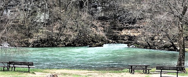
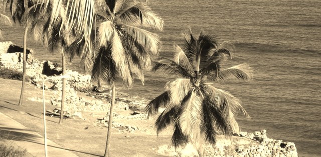
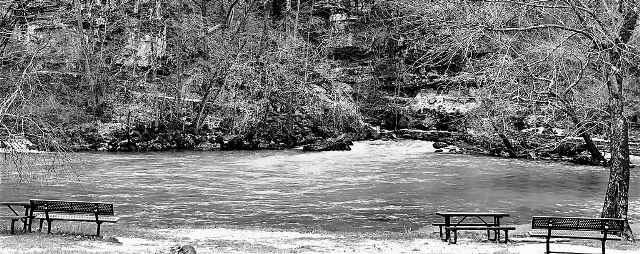
A boy wading in the pool below the Big Spring spied a piece of bark floating toward him. When he lifted the bark out of the water, he saw a long, slimy, white creepy-crawler attached to it.

“Yuck!” He tossed the bark away. It arced into the air and landed on the water, upside down. The creepy-crawler was nowhere to be seen.

Repulsed, the boy stumbled to the bank of the pool and the comfort of his mother.

The Place: Big Spring, Missouri

Though spring is gone and summer now over, for some reason my thoughts turn to springs, those remarkable eruptions of water from subterranean depths. They come in all sizes, from trickles no bigger than water in a drinking fountain to wild and powerful torrents. The largest spring in the U.S. is the prosaically named Big Spring in Missouri, though Florida and Idaho also have contenders.

Big Spring

Big Spring, courtesy Johnston9494

Of aquifers and pressure:

Groundwater from millennia of rainfall and snow accumulation have seeped into the porous limestone of the Missouri Ozarks, super-saturating it to form aquifers. These vast underground water collections exist in darkness, inhabited solely by unicellular organisms and pale eyeless creatures—depleted by droughts and human use, replenished by precipitation. Pressure builds up and forces the aquifer water through a tunnel at the base of a bluff, where it bursts through to the Earth’s surface as Big Spring.

How big is big?

Though the amount of water flowing from Big Spring fluctuates with the whims of man and nature, the average daily flow is 286 million gallons, more than 3,000 gallons per second. The water travels through underground passages from as far away as 45 miles. Along with the water comes dissolved limestone, some 70 tons of it every day. Which means the water is continually enlarging an impressive cave system as it journeys toward the dazzling light of day.

Recreational opportunities:

ccc_cabin_3

Big Spring cabin, courtesy NPS

Located in southeastern Missouri, Big Spring is part of the Ozark National Scenic Riverways, the first national park area to protect a river system. In addition to viewing the site where the spring originates on its way to merge with the Current River, the locale features paths and hiking trails, spacious picnic areas, a campground, and the historic Big Spring Lodge and Cabins. Currently closed for restoration, the lodge and cabins were built of local materials—rough-cut limestone blocks and dark-brown stained timber—and feature the Depression Era style of architecture.  They and other recreational projects in the park, from roads to trails and the campground, were constructed in the 1930s by CCC workers—unemployed, unmarried young men who voluntarily became part of the Federal government’s public work relief program.

The other spring contenders:

Silver_Springs_State_Park_-_Glass-Bottom_Boats_2017

Silver Springs, courtesy Jackdude101

According to the park website, more-or-less equal flows gush out of Silver Springs in Florida and the Thousand Springs Complex in Idaho. Located in north-central Florida, Silver Springs State Park has a Disneyesque quality to it –  ‘world-famous’ glass-bottomed touring boats, kayak rentals, gardens, a museum and gift shop, and restaurants. It also looks hauntingly beautiful, with a meandering sapphire-blue river and trails through sandhill forest of grasses, palms, and longleaf pines.

The Thousand Springs State Park along the Snake River in southern Idaho consists of several separate units of distinct natural beauty — gorges and islands, historic structures and trails. Only two of the units seem to have major springs – Niagara Springs and Crystal Springs in one and Box Canyon Springs in another. Niagara seems to be the largest, plunging down a canyon wall at 250 cubic feet (1,870 gallons) per second, not nearly the flow of Big Spring. Do we add the flow of all the thousand springs to equal Big Spring? It’s not clear.

In short, I’ll stick with Big Spring as the winner.

The Story: Tristan da Cunha

 Author’s note: To get the most out of this story, I recommend you first read the previous blog about the place. Thanks!

Diane sat on a wall bordering the family’s small vegetable plot, set on Tristan’s largest plain and wedged between towering cliffs and the ocean. The day was chilly and windy. Clouds had massed across the sky, but at least they released no rain. She wrapped her threadbare jacket tighter across her chest.

Half the family plot was devoted to potatoes, the other half to seasonal vegetables. Diane had just finished pulling up a basket-full of carrots — perhaps for the last time — and was resting before the walk back to The Settlement. She felt small in the face of such dramatic natural beauty, alone in the stillness of the moment.

Getting up, she crossed the mosaic of plots and headed for The Settlement. A figure approached her — Mrs. Green, hoe and bucket in hand, on her way to the Potato Patches. Oh dear.

“Morning,” she said as the woman passed. The woman looked the other way and didn’t respond.

Craig Green was her boyfriend – or had been until she told him she was leaving the island for a while. “You can’t do that,” he’d objected. “We’re going to get married.” Craig was a good person, but set in his ways, taciturn and resigned to the monotonous existence on a tiny island with fewer than 250 people and thousands of miles from any others. Well, she wasn’t.

When she announced her plan to spend a year in England, her family had reacted in predictable ways.

Her father had shouted. “You’re only twenty years old! I’m not letting you go alone to a country full of murderers and rapists. And what about Craig? His father and I have been planning your wedding for years. Not one pound of money will you get from me for this idiotic scheme!”

Diane knew the stories – the Glass boy who went to London and died in an attempted robbery; the Swain girl who came back after a year and was never again quite right in the head. But still, England beckoned, luring her with its unimaginable wealth of . . . of life.

Her mother had wept. “Why England? It’s half a world away. If you must go, why not just a month in Cape Town?” She glanced at her husband. “We could help pay for that.”

Her mother’s pleas made sense. There was no airport on Tristan da Cunha. To reach Cape Town, South Africa meant a six-day’s journey by ship. That alone would certainly be an adventure. To go on to England, she’d have to take a plane flight that lasted twelve hours. She’d never been on a plane. The journey was long, complicated, and expensive. She’d saved some money from babysitting and tutoring, but not nearly enough. If it weren’t for . . . no, she would keep the secret a secret, even in her own head.

Her younger brother had exulted. “Oh boy! Does that mean I get your room?”

Once in The Settlement, Diane turned down a road that led, not to her house, but to that of her grandmother. It was a small white-washed structure of volcanic tuff, wood trim, and a metal roof. Grandmother Repetto lived alone since the death of her husband ten years earlier. She seemed an aloof old woman, but she always welcomed Diane.

When Grandmother Repetto was Diane’s age, in 1961, a volcanic eruption on Tristan caused earthquakes and landslides and forced residents to flee the island by ship, first to Cape Town, then on to England. Two years later, most residents wanted to return to their tiny remote island in the middle of the vast South Atlantic. Her grandmother did not. Enthralled by shops and theaters, cafes and parks, and people of all descriptions, she’d begged her husband to stay in England. He refused. The rest of her life she told stories of her time in England to anyone who would listen. In recent years, the only listener was Diane.

When Diane entered the house, Grandmother Repetto hugged her, then stepped back and handed her a large purse bulging with pounds sterling. “Remember, dear,” she said, placing a finger against her spidery lips, “it’s our secret.”

With a nod, Diane held the purse and smiled, but her knees trembled.

The Place: Tristan da Cunha and Bouvet

After I wrote the story about the man on Saba for my last post, I thought more about the urge to search out places that are remote in the extreme. Why do some people have that urge? Where are these places, and what are they like?  Although I’d be hard-pressed to answer the ‘why,’ it took little effort on my part to learn the ‘where’ and ‘what.’ The two places that vie for the most remote places on Earth are the islands of Tristan da Cunha and Bouvet.

Tristan Settlement by Gratwicke

Tristan Settlement, courtesy Brian Gratwicke from DC, USA

Formation:

Imagine a time millions of years ago as tectonic plates shuffled continents into their current positions. South America and Africa detached and separated, and hotspots developed in the remote South Atlantic. Volcanoes rose above the ocean, erupting in fiery splendor in the nighttime sky and forming these two lonely, far-flung islands.

Tristan da Cunha, true isolation:

Tristan by Gratwicke

Tristan, courtesy Brian Gratwicke

Tristan da Cunha is billed as the most remote inhabited place on Earth. How remote is it? Here are the statistics – it lies 1,743 miles west of Cape Town, South Africa; 1,509 miles south of Saint Helena, an island isolated enough to hold Napoleon in exile; and 2,424 miles east of the Falkland Islands (which are 300 miles east of the South America’s Patagonia). The island is seven and a half miles in diameter, and its peak rises 6,750 feet above sea level. It is surrounded by several smaller uninhabited islands.

A bit of history:

Tristan potato patches by Gratwicke

Tristan potato patches, courtesy Brian Gratwicke

First discovered by the Portuguese sailor Tristao da Cunha in 1506, the island was known to international trade ships on their route back to the Old World, and to US whale and seal hunters. In the early 1800s, it became a British garrison.  Due to the lack of a natural harbor, scant arable land, and a harsh climate – although not as cold as I would have thought, with average temperatures ranging from 49 to 70 degrees Fahrenheit, the island does get a lot of rain and constant winds – few people could survive here. All of today’s residents descend from seven surnames of original settlers who came to the island in the 1800s from Scotland, the US, Italy, South Africa, and other countries. In 1961, an eruption of Tristan’s volcanic peak resulted in earthquakes and landslides. Residents were evacuated to England. Though expected to remain in England permanently, the hardy islanders defied expectations, and most returned to Tristan in 1963.

Tristan today:

A British Overseas Territory, Tristan is home to some 250 citizens who reside on a lip of land that juts out from the base of the volcano, in a community officially named Edinburgh of the Seven Seas but referred to by locals as The Settlement. Here are the usual churches, hospitals, schools, and shops as well as a golf club and a scientific monitoring station. Residents are resilient, and the community is self-sufficient through subsistence farming and some commercial fishing. Land is communally owned, and no outsiders are allowed to buy land or settle on Tristan. A scattering of tourists visit each year (but not right now with the pandemic), arriving from Cape Town by commercial or cruise ship, hiking to peaks and ponds, viewing the unique flora and fauna, and ending the day with a drink at the Albatross Bar.

Bouvet Island:

Bouvetøya

Courtesy Andre NARE (Norwegian Antarctic research Expedition) 1978-79

Travel some 1,400 miles southeast from Tristan and you will come upon Bouvet Island, the most remote uninhabited place on Earth. It is slightly more than a thousand miles north of Antarctica, but still plenty cold. Its landmass – 5.9 by 4.3 miles – consists of an inactive volcano and cliffs up to 1,600 feet high, virtually all covered by a glacier. Only one place, created by a rock slide in the 1950s and home to an automated meteorological station, offers (highly dangerous) access to Bouvet. A French naval officer, Bouvet, discovered the island in 1739, but wrote down the wrong coordinates, and it wasn’t rediscovered, by the British, until 1825. A century later, several Norwegian expeditions made extended stays here, and Bouvet became a Norwegian dependency. In 1971, the island and surrounding water were declared a nature reserve, sheltering seabirds, penguins, seals, fish, and such flora as fungi and mosses.

Two Bouvet mysteries:

First, a phantom island: Some 40 miles from Bouvet, Thompson Island was sighted at least twice in the 1800s and placed on maritime maps as recently as 1943. However, it no longer exists: possibly, it disappeared in a volcanic eruption, but the depth of the ocean there makes that theory all but impossible. Or it never existed, a ghost island to travel-weary sailors. Second, a crewless lifeboat: In the 1960s, a lifeboat was found abandoned by the rock slide: though the boat was loaded with supplies, no crew members were ever found. Hmmm . . .

The Story: Saba

 Author’s note: To get the most out of this story, I recommend you first read the previous blog about the place. Thanks!

You pull open the shutters to get relief from the humid heat and look out on a view framed by banana fronds and lime trees in the foreground, backed by sweeps of forest and cliffs angling into deep blue sea. This is your new home, the third you’ve lived in since you arrived on Saba.

An alignment of mixed-bag events brought you to this tiny cone poking out of the Caribbean.

First, your girlfriend of many years decided it was time to move out, and on. You have to admit, her announcement smacked you in the gut. You had no idea she wasn’t content with the status quo.

Second, you came across a notice inviting visitors to apply for long-term visas to the island of Saba. With the pandemic, you had no chance of finding a new roommate, and you couldn’t possibly pay the rent for your Manhattan studio alone.

You looked Saba up in an old, tattered book bought in a dusty hole-in-the-wall bookshop. Touring the Jewels of the Caribbean. The author gave the island short shrift. Scarcely three miles in diameter. No beaches, steep terrain. Fewer than a thousand inhabitants, more women than men. A strange community of white natives. Neglected by the modern world.

It sounded perfect.

So you broke your lease, flew to St. Marteen, and gained a few gray hairs on a puddle jumper that narrowly avoided plunging into the water on Saba’s impossibly short runway. Followed by a dizzying taxi ride on a narrow road that snaked around precipitous hills and ever-farther-flung views on its way to the island capital. The Bottom, it was called, for the concave shape of the terrain.

It turned out your tour book was outdated. Saba’s population had doubled since then, electricity had arrived, and a medical school, of all things, had been established on the edge of town. After two weeks of discotheque music blaring into your bedroom at night, you moved to Windwardside. A tiny village of white bric-a-brac cottages sprawled across a mountain flank, it seemed far enough away from the medical school to afford peace and quiet.

Quiet it was, but the residents, many of them with pale wizened skin, wouldn’t give you a moment’s peace. They brought over food, shared bottles of spiced rum, introduced you to friends and relatives, regaled you with tales of island lore, and interrogated you about your own pre-Saban life. After two weeks of living under a microscope, you moved to Hell’s Gate.

As you look out the shutters of your new home – tiny, box-shaped, and wood-shingled – you see a rooster pecking in the soil next to the banana plant. Though only a smattering of people live here, there is an overabundance of poultry and livestock – chickens, roosters, goats, pigs, and the like. They are indifferent to the constraints of time and place. Roosters crowing, pigs oinking, goats bleating – you haven’t had a good night’s sleep since you moved in.

You lock the door of your new home and strike out on a barely perceptible path that parallels the northern reaches of the island. You’ve taken the path before, enjoying stunning views and no people, but that is not why you are here today. You remember an island tale about Mary’s Point, a village so remote, so inaccessible that residents lived out their entire lives there, never venturing beyond. As the years went by, the villagers died off, marriages occurred between ever fewer families, and their offspring suffered the results. One day, officials from The Bottom came and evacuated the entire village, for their own good.

But, you think, there may be something left of the village, and if there is, you can move there. What a joy that would be, bothered by no one, no noise except for the rustling of leaves.

When you arrive at what on the map appears to be Mary’s Point, you search the area. There are no abandoned homes, no outbuildings, only fragments of stone walls and a bottle or two half hidden in decaying leaves. Not enough to start a new life. Disappointed, you turn to retrace your steps back to Hell’s Gate.

But you can’t move. The air seems to have thickened, and you become inordinately tired.  Noticing a log next to your feet, you sit down.

A figure approaches through the trees. A man of indeterminate age, with skin the color of ashes, a bulbous nose, cauliflower ears, and porcine eyes. His clothes seem to have been made from forest vines. He stops several feet away.

“Do you live here?” you ask. The words come out in a slow-motion croak.

The man stares at you with his tiny eyes. Slowly, his lips begin to move, jerkily, as though unaccustomed to use. “I be here a long, long time,” he says.

You look down. Vines tickle your ankles.

With a sudden stab of terror, you realize that you may be, too.

The Place: The Dutch Caribbean Island of Saba

To the northwest of the Caribbean island of St. Eustatius [see my previous blog], a lone mountain pokes out of the sea. Underwater, the mountain’s flanks drop thousands of feet to the seabed; above, no beaches line the coast and the terrain is steep, with an impressive, long dormant volcanic peak on top. This is Saba, “the unspoiled queen of the Caribbean.”

Saba silhouette. Richie Diesterheft, Wiki Commons.

Geographical curiosities:

Saba measures less than three miles in diameter, a mere speck on the ocean. Fewer than 2,000 residents cluster in several small communities where the land is relatively flat. In spite of these humble statistics, its Mount Scenery, at 2,910 feet, is the highest point in the entire Kingdom of the Netherlands.

Getting there and around:

Early visitors likened Saba’s shape to that of Napoleon’s tricornered hat. On a horizontal outcropping of the hat, appropriately named Flat Point, lies a 1,300-foot landing strip, said to be the shortest commercial runway in the world. Flying in and out is often a white-knuckle experience, but the only alternative is by ferry from St. Marteen.

Windwardside. Radioflux, Wiki Commons.

Up until the early decades of the twentieth century, Saba had no decent harbor, and the only way to cross the island was on winding, steep step roads—some 200 uneven steps from Fort Bay to the seat of government at The Bottom; and countless more from The Bottom to Windwardside, a rural community where many homes resemble tidy gingerbread cottages. Dutch engineers said a concrete road for cars could never be built here, but local resident Josephus Lambert Hassell, armed with a correspondence course degree and his Saban crew, proved them wrong. Without the help of machines, the men created an engineering marvel in less than a decade.

A thumbnail overview:

Cliffs of Saba. Richie Diesterheft.

Several indigenous groups had lived on Saba for centuries before Columbus sailed by. He eyed its rugged hills and sheer cliffs and decided not to make landfall. Later, small groups of Europeans settled, and Saba was contested by the English (often enough that most Sabans speak English), Dutch, Spanish, and French until the Dutch won out in 1816. Saba’s population—descendants of slaves and of European settlers—remained small well into the twentieth century. For the most part, the two groups of descendants lived apart, and Saba is one of very few places in the Caribbean, or anywhere in the tropics, with a long-standing light-skinned population. A majority of Saba’s males, able seamen, left the island for years at a time, some never to return. The island was left with a preponderance of women, many of whom came to excel in lace work and other crafts.

In recent years, the island has seen an increase in tourism by off-the-beaten-track travelers who don’t mind the lack of permanent beaches. Popular recreational pursuits include hiking along mountain trails and scuba diving in pristine Saba Marine Park, which skirts the entire island. Stunning slopes and drop-offs feature unspoiled coral gardens and curtains of fish in kaleidoscopic colors. Since 1992, Saba University School of Medicine has provided an accredited alternative for U.S. and Canadian medical schools, with up to one hundred students a year attending its campus at The Bottom.

Our hikes:

When my husband and I visited Saba, back in the 1980s, we concentrated on hiking. The first day we took the most popular trail, from Windwardside up to the top of Mt. Scenery. A mostly paved path of a thousand steps plunged us into lush rain forest and gnarled cloud-forest vegetation before opening onto a spectacular view of the Caribbean as far as the eye could see. Though we were up and back in under three hours, our knees complained for days. We decided to forego a walk descending and ascending The Ladder, historic stepped route for men and donkeys hauling supplies from the coast to The Bottom.

Trail to Mt. Scenery. Richie Diesterheft.

The second day we arranged for a guide to take us along a trail starting at Hell’s Gate and more or less paralleling the north coast. It was a trail in name only, and we needed our guide to show the way through dry forest that opened onto spectacular coastal views. A couple of hours into the hike, we reached Mary’s Point. While my husband and I looked around for old bottles and other artifacts, our guide told us the story of the point. For centuries it had been an almost inaccessible hamlet, perched far from the main paths, and residents could spend their entire lives without leaving. The hamlet dwindled until, by the 1930s, Mary’s Point had only 32 people divided among eight families, and the effects of intermarriage were pronounced. In 1934, the government evacuated the hamlet and resettled the remaining residents near The Bottom.

We found very few traces of the old community.

The Story: Sint Eustatius

Author’s note: To get the most out of this story, I recommend you first read the previous blog about the place. Thanks!

Ralph did not like to follow directions. Much less, directions given by someone half his age who had a bronzed body without an ounce of extra fat and a halo of dark curly hair lightened at the tips by the effects of sun and salt water. Jamal was his snorkeling guide to the underwater treasures of Sint Eustatius.

With his face encased in a smirk, Ralph let his mind wander as Jamal instructed the small group of fellow vacationers on the proper use of snorkeling gear, the dos and don’ts for a safe underwater journey, and snorkeling etiquette.

Blah blah.

Etiquette included not touching the coral or any artifacts embedded on the ocean floor. “Statian spirits retaliate BAD.” Jamal joked his warning in an overly affected island singsong, geared to make the ladies in the group swoon. Which they did.

His wife had talked Ralph into spending the morning snorkeling, just as she had talked him into spending a week on this speck of an island. Never satisfied with mainstream travel, Edith would scour the tour books for the most remote, godforsaken places. She’d outdone herself on this one, an island five miles long, sporting more churches than bars, more goats than people, and an extinct volcano on one end that neither of them could climb. In fact, snorkeling was the only excursion that might not tax their overweight bodies.

Snorkeling here involved more than just oohing and aahing over ornate coral formations and schools of iridescent fish. Oranjestad’s Lower Town dated back to the 1700s, when Statia was a trade mecca. Thousands of ships sailed into the bay every year, and hundreds of warehouses and homes crowded the narrow street paralleling the bay. Eventually, trade went elsewhere, and part of the town sunk into the sea.

Ralph sat in the sand at water’s edge, his neon-yellow swim trunks partially submerged. He fit the mask over his eyes and nose, adjusted the snorkel mouthpiece, and tugged the fins onto his feet. All the while, he eyed tilted stone and brick walls and foundations scattered along the beach. Trees sprouted from some of them. Submerged in the water, Jamal told them, were more ruins as well as ship wrecks and trade objects from virtually every country in Europe. “All belong to Statia now,” he warned them again.

Yeah yeah.

Ralph trundled backward into the water, then began to swim off on his own. “Wait for me, Ralph,” Edith shouted, but he ignored her. He also ignored Jamal’s waving arms some time later. He was farther out than any others in the group, and he liked it that way. The coral and the fish would have knocked his socks off if he’d had any on, but he was more interested in artifacts that peppered the sea bed — hand-blown bottles, irregularly shaped glass beads, corroded anchors, ivory pipes, metal plates and cups.

A glint caught his eye. He powered his fins until he was above the glinting object half buried In sand. It looked like a tiny covered serving bowl with a spout on one end and a handle on the other, but instead of ceramic, it appeaared made of gold.

My my. Ralph’s heart palpitated irregularly.

Taking a deep breath, he dove and pried the object from the sea bed. Returning to the surface, he gasped for air, then glanced toward shore. Jamal, no longer waving, was putting on his snorkeling gear with angry, jerking motions.

Uh oh.

Rubbing the sand away, Ralph studied his treasure. It was beautifully made, with what looked like Arabic lettering on the sides. Definitely gold and definitely worth a fortune. In hurried motions he stuffed the lamp into his swim trunks and wished for Jamal to disappear.

Quick as lightning, the water rose up with a swishing noise. It tossed him head over heels, round and round, before spitting him onto dry ground. Heart hammering against his chest, he found himself sitting on a narrow street surrounded by massive warehouses and the stench of old urine and unwashed bodies. Crowds dressed in costumes from a Shakespearean play jabbered in languages he could not understand. Their fingers pointed at his neon-yellow trunks and brightly colored fins, mask and snorkel.

No. No . . .

The Place: Sint Eustatius

Along with the Spanish, British, and French, the Dutch sailed into the Caribbean centuries ago, planting their flag and leaving a legacy on six islands – Aruba, Curacao, Sint Maarten (only half of the island; the other half is French), Bonaire, Sint Eustatius (informally, Statia), and Saba. Over the years, they have formed an alphabet soup of connections – ABC for the three islands near the coast of Venezuela; SSS for the three much farther north in the Lesser Antilles; ACS for Aruba, Curacao, and Sint Maarten, now constituent countries within the Kingdom of the Netherlands; and BES for Bonaire, Eustatius, and Saba, special Dutch territories. Of all of them, Statia and Saba are ‘by-way’ islands – tiny, sparsely populated, and off the beaten tourist path. Which made them alluring to my husband and me back in the 1980s. Today I’ll return to Statia; next time, Saba.

Lower Town, Statia, courtesy Walter Hellebrand, Wiki Commons

Statia of the tour books:

Shaped like a drop of water, Sint Eustatius scarcely reaches five and a half miles in length and three miles at its widest. An extinct volcano rises to the south, low-lying hills to the north, and, wedged in between, a sunbaked plain. Today, the plain encompasses a small airport, grazing land, and a dozen crisscrossed streets that make up the island’s lone town, Oranjestad, home to most of Statia’s 3,000 residents. Though teeny in size, Oranjestad boasts an Upper and Lower Town, boxy houses of stone or wood shingles, and neatly tended yards bright with bougainvillea.  In Lower Town, dozens of stone walls and foundations are scattered along the beachfront and underwater, remaining testament to the island’s heyday three hundred years ago when Statia, nicknamed the Golden Rock, was the wealthy trading capital of the West Indies.

Statia in its heyday, courtesy Museum van Wereldculturen

Statia’s prime location in the heart of the Caribbean colonies (so prime it changed hands twenty-two times), its good anchorage and free-port status made it a veritable trade bonanza. Hundreds of two-story buildings were crammed cheek-to-jowl along a narrow mile-long street, and merchants hawked everything from sugar, ammunitions, and slaves to salted fish, wines, and colorful silks. In 1776, a fort above town gained fame for offering the first salute by a foreign government to the American flag on a U.S. naval vessel. Memorable stuff: however, before long, trade moved to more lucrative ports, and Lower Town fell to weather and neglect.

Today, Statia is known for its small resort hotels, several restaurants, snorkeling and diving around the underwater ruins, sightseeing land ruins including one of the oldest Jewish synagogues in the New World, hiking up the volcano, and enjoying the island’s friendly laid-back atmosphere.

My personal Statia:


Mount Mazinga, courtesy Walter Hellebrand

My husband and I hiked the Quill, the volcanic crater (kuil in Dutch) at the top of Statia’s Mount Mazinga. The crater is 1,900 feet high, 1,000 feet across, as symmetrical as a bowl, and smothered in rain forest. An hour’s steep hike got us to the rim. A path edges the rim through shadowy cloud forest to the opposite side. We took it. At the far side, the path mysteriously stops. Adventurous, we decided to complete the rim circle. Why not? Well, this is why not: at one point the rim is scarcely two feet wide (as I remember it), wedged between sheer drops many hundreds of feet to the crater floor and the sparkling Caribbean Sea. All these years later, I still shudder when I think of that two-foot wedge.


The Story: Victoria

Author’s note: To get the most out of this story, I recommend you first read the previous blog about the place. Thanks!

1785.

Sarah pulled the stiff water-proofed coat tighter around her body. It was her father’s and fit her like a tent. The cold rain came down in diagonal sheets. She huddled next to a log under a wooden door at the edge of a long strip of sandy beach littered with pebbles and driftwood. The ocean nipped at the shore in angry bursts and erupted in frenzied whitecaps across the strait. On the far side she could barely make out the dark outline of the Olympic Mountains. Beyond them, far to the south, was Fort Vancouver. Her home.

Why hadn’t I stayed there?

A twig snapped behind her. She twisted her body, causing a rivulet of water to pour from the coat onto her shirt and pants. The forest, thick with tall evergreens and beds of ferns, appeared dark as night even though it was mid-afternoon. She could see no movement within the gloom but nevertheless scrunched closer to the ground.

Her father, a hunter of animal pelts, worked both in forests and along the coasts. Several times a year he and several other men from the fort set sail to catch seals, sea lions, and, most coveted, sea otters, with their thick, silver-tipped fur. They would trade the pelts to merchants heading across the ocean to China. The trips would take weeks, even months. Sarah preferred her father over her mother, just as she preferred men’s work over that of women, and when he was gone, she missed him terribly. Three months earlier, she had turned fifteen. When he readied for another boating trip, she begged to go along, so much so that, against what he called his better judgment, he finally relented.

“Don’t let me regret this,” he warned when they boarded the boat.

And now he was dead, their boat sunk, and she, the only survivor, alone in a vast wilderness. Sarah brushed at the tears but could do nothing about the slash in her heart.

The hunt had gone well for the first couple of weeks. They circled Olympic Peninsula and crossed a strait to reach a forested coastline that some said was part of a large island. Hundreds of otters sunned on the beaches or cavorted in the shallow waters. Rejoicing in their good fortune, the men used harpoons and clubs to kill the animals, then skinned them on shore.

Sarah helped with the skinning, and even killed a few with a harpoon. “You’re as good as any of my boys,” one of the hunters told her. Her father smiled and patted her on the head. Though her hands were raw from the wet cold and crisscrossed with knife cuts, she nearly burst with pride.

“Pride cometh before a fall,” her mother had often admonished her. She must have been clairvoyant. On what was to be their final kill before returning to Fort Vancouver, the wind whipped up and fog became so thick she could scarcely make out the tips of her fingers. Suddenly, there was a thunderlike crack. The boat lurched, and the prow of another boat came to rest on its deck. Shouts of fury flared up around her, half in English, half in a foreign language, Spanish perhaps. The men began to fight each other, using fists, harpoons, and clubs.

One man clubbed her father, and he collapsed onto the deck in a heap. She started toward him, but her uncle held her back. “Wait.” He crept over to her father, examined him, pulled off his coat, and crept back. “He’s gone, nothing you can do.” With a strength forged by grief, he ripped the door from the room where they stored the pelts, then tossed it in the water. Wrapping the coat around her, he pushed her off the boat. “Go. Save yourself,” were his last words.

What good is being saved if everyone else is dead?

Once on the beach, she dragged the door to a log and, in her makeshift lean-to, fell in and out of sleep for the rest of the day and through the night. Several times, unknown forest sounds caused her to awake trembling.

When morning came, shining shafts of light streaked the forest. The rain had stopped. Moving the door, she got up and straightened her body. I wish I had died, too. She did her best to tamp down the panic in her stomach.

Something moved in the forest. Someone, she realized and stopped breathing. A girl around her age, with dark skin, wore a rough-hewn skirt and shawl. Her long black hair was parted in the middle and braided. The girl, moving closer, said something Sarah didn’t understand, though the words sounded kind. She seemed to be alone. When they were face-to-face, the girl stretched out a hand.

Sarah clutched it.

The Place: Victoria, British Columbia

Three years ago, long before the current pandemic shut the border between the U.S. and Canada, my husband and I traveled to Victoria, capital of British Columbia, Canada’s westernmost province. Though modest in size—350,000 people in greater Victoria—it was western Canada’s first British town, is considered the most British of Canada’s cities,  enjoys mild maritime weather, and sits at one corner of a spectacularly beautiful island.

Courtesy Brandon Godfrey, Wikipedia Commons

Getting There:

Gulf Islands

Vancouver Island, resembling a fat 300-mile-long cigar, fits like a  missing puzzle piece into a hook of land that stretches from Olympic Peninsula, to the islands north of Seattle, around the city of Vancouver, and on up the Pacific coast. From our home in Spokane, WA, the car drive was a journey in itself – across the North Cascades mountain range, down to the island city of Anacortes, on a car ferry through Washington State’s beautiful San Juan Islands and Canada’s Gulf Islands to the ferry terminal on North Saanich Peninsula and, once again on highway, south to Victoria.

Of Victoria and Vancouver:

Totem

A number of indigenous communities, primarily of the Coast Salish people, settled on Vancouver Island long before the arrival of Europeans. They spoke several languages and dialects, and I imagine the island itself was known to them by several names. With the arrival of Europeans, there was eventually one name – Vancouver – for a variety of places. Why Vancouver? George Vancouver, an officer in the British Royal Navy, explored the Northwestern Pacific coast in the 1790s and wound up with his name on three sites in the region. The first was Fort Vancouver, established just north of the Columbia River in Washington State. In 1843, a fort, later known as Fort Victoria for the British queen, began as a trading post on Vancouver Island. With a gold rush in the region in the late 1850s, the fledgling outpost mushroomed into a bona fide town. When British Columbia became a province, in 1871, Victoria was named its capital. Later, the city of Vancouver was founded on the mainland.

Downtown Victoria:

Parliament

Historic Victoria wraps around Inner Harbour, making it a lovely place to explore on foot. In wandering along the harbor, we passed dozens of very British buildings of Edwardian architecture, popular in the early 1900s. Two of the most massive are the Parliament buildings and the elegant Empress hotel, where high tea is a daily ritual (in season and probably pre-pandemic); unfortunately, it was a ritual my husband didn’t care to try. Interspersed around the city’s buildings are brightly colored carved totems that reflect the First Nations heritage. The city has numerous museums, parks, galleries, shops, and restaurants, but we only had time to sample a few — a curious museum of miniatures (billed as the greatest little show on earth), several bookstores, the Craigdarroch Castle (actually, the ill-starred Victorian mansion of a coal baron), and Chinatown, which, though small, is the oldest in Canada, historic home to Chinese who came, first, in the hunt for gold, and later, to work the railroads.

Butchart Gardens:

Sunken Gardens

We hadn’t even stopped in Victoria when we made a detour to Butchart Gardens, located halfway between the ferry terminal and the city proper. In 1904, the Butcharts bought land around a limestone quarry in Brentwood Bay. When production of cement from the limestone was exhausted, Jeannie Butchart envisioned transforming the site into a sunken garden. Over the decades, the gardens expanded to include not only the sunken garden but also Japanese and Italian gardens, and a rose garden. Today, Butchart is a National Historic Site, encompassing 55 acres and retaining 50 full-time gardeners. It is worth a visit any time of year. We went in early October, and the gardens were still alive with a wealth of flowering plants.

The Pacific Marine Circle Loop:

China Beach Provincial Park

Our final day we ventured out on Vancouver Island, heading southwest to the small town of Sooke and the Pacific Marine Circle Route. At Sooke, we took a short walk to a spit of beach at the gateway to the harbor. The road paralleled the Strait of Juan de Fuca (named for a Greek maritime pilot sailing for Spain who may never have reached the strait), with views across the water to the Olympic Peninsula. We stopped at China Beach Provincial Park and walked on path and steps through lovely old-growth forest of Sitka spruce, Douglas fir, and Western red-cedar before reaching a long uninhabited sweep of beach. Deep green forest on a bed of ferns, pale beige sand, deep blue ocean, and hazy green mountains across the way – it was truly a magical spot. Then we continued along the road, paralleling the well-known Juan de Fuca Marine Trail, to Port Renfrew (if it had a downtown, I missed it) and inland across the island. After passing the large Cowichan Lake, we reached Highway 1 on the north/east coast. I would have loved to have continued west to the end-of-the-line village of Port Hardy and view the island’s vast wilderness of forests, trails, and secluded beaches, but that will have to be another, post-pandemic trip.