The Story: Cáceres

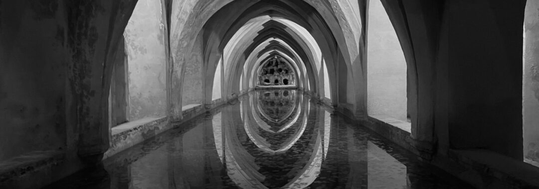
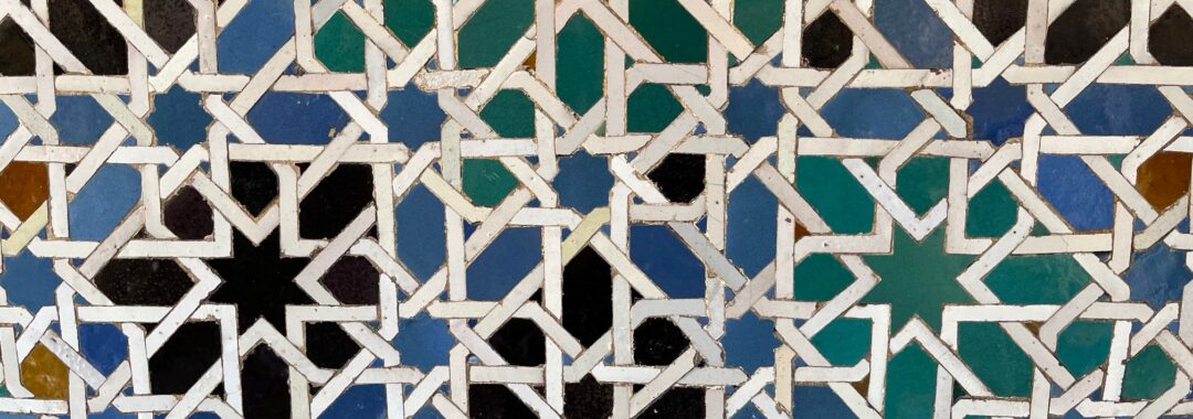
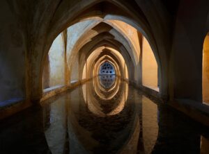
Author’s note: To get the most out of this story, I recommend you first read the previous blog about the place. Thanks! 

One morning, Enrique’s mother handed him a bota, a wineskin made from goat hide, and told him to go to the cave and fill it with wine. “Your father and brother will be spending the night in the olive grove. I’ve prepared a basket of cheeses, ham, olives, and figs, but there’s no wine in the house.”

Enrique didn’t want to go. His uncle had brought him pieces of parchment the night before, and he was sketching the outline of a cat sleeping in the house’s small inner courtyard. The cat would probably be gone by the time he returned, and even if it wasn’t, the light would be all wrong. But he couldn’t say no.

With a sigh, he took the bota and plodded to the front door. “Enrique, move. The men will be leaving soon. None of your daydreaming. Go!”

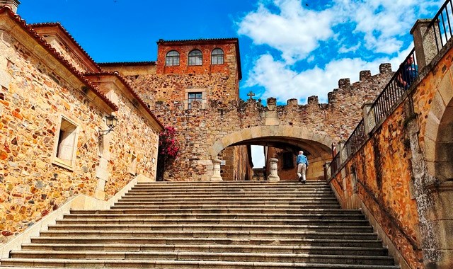
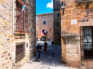
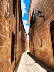
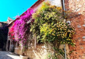
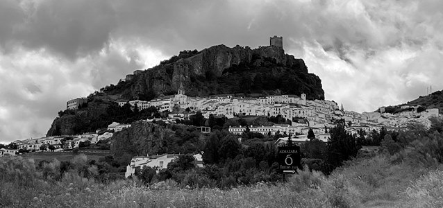
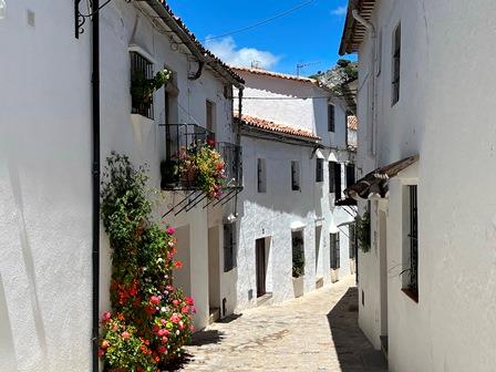
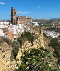
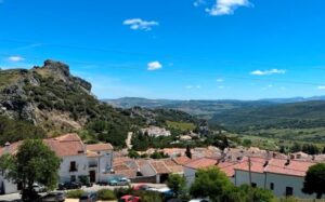
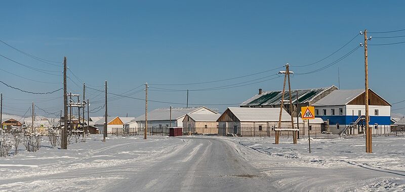
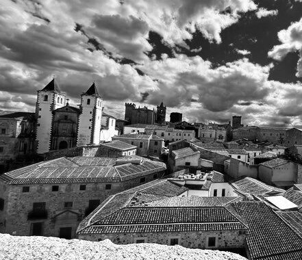
He pulled open the heavy wooden door, slipped out, and closed it. His hand stroked the whitewashed wall as he made his way in the direction of the cave. His house lay just outside the massive wall that encircled the city of Cáceres. It was sturdy, with a red tile roof, comfortable for his parents, his older brother and sister, and himself. Though it didn’t compare with the stone towers and palaces crammed within the city walls, it was nicer than most homes in the area.

His brother was learning the business of cultivating olive trees, harvesting the olives, and processing them into oil. He would follow in his father’s footsteps. His sister stayed by his mother’s side, learning to cook and clean and sew, skills that would make her a good wife. Enrique was left to his own devices, for the moment, which made him the obvious choice for any errands that needed to be done. What he wanted to do when he got older was go to school, but his father paid no attention to that idea.

The wine was stored in large earthenware jugs called tinajas, in a cave on the edge of the olive grove. The day was hot, the sun intense, and Enrique wished he’d remembered to wear a hat. He looked back at the rooftops and towers of the city. A stork nest crowned one tower. He kept an eye on it. Every day the mother stork would fly away and return with bits of food for the chicks. He wished he could fly like that. He might take off and never return. If he wanted.

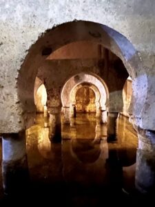
A half hour walk took him to the cave, a long, low cavity in a small hill of rocks. Here the family stored, in addition to the wine, grains, dried meats, and the paste that remained after the crushed olives were strained into oil. The cave was long and narrow. The wine tinajas abutted the back wall, where light scarcely reached, and he usually had to fill the botas mainly by sound and touch. Today, however, the sun was in just the right position in the sky to shine its rays into the back crevasses. He easily walked in, opened the plug of one jug, and began to fill the bota. For the first time, he noticed drawings above the tinajas, and when he finished his task, he examined them. They were outlines of hands, dozens of hands, painted in earthen colors. He placed his hand in one of them: The outline was much larger than that of his hand. He wondered at the primitive but whimsical art.

In the following weeks, Enrique volunteered for any task that took him to the cave, and he made sure to go when the light would shine into the back of the cave. The paintings intrigued him: Who drew them? What did they mean? How old were they? He told no one about his find.

One day he was studying the hands and didn’t hear his brother come into the cave. “What are you looking at?” his brother asked. “Didn’t Mother tell you to return home quickly?”

Enrique wished he could hide the hands, but it was too late. “I just noticed these drawings on the wall. I wonder who made them.”

His brother glanced at them impatiently, then turned away. “Someone with too much time to waste. Like you. Get going.”

Several months later, the Angel of Death struck the region. Most people in Cáceres became sick, and many died. One of the dead was Enrique’s sister. After Death passed, he helped his father and brother whitewash the house, inside and out, to purify it. The next time he approached the cave to fill a bota with wine, he froze in horror. White rimmed the cave. He stepped forward slowly, his heart pounding, and peered inside. The interior had been whitewashed. The hands were gone.

He ran to his brother in the olive grove. “You destroyed the paintings!” he screamed at him.

His brother eyed him as if he’d gone mad. “What’s wrong with you? There was extra whitewash, and I thought it would be good to clean the place where we store our foods.” He shrugged. “So?  The cave looks better now without those scribbles.”

The Place: Cáceres, Spain

“You’ve got to go to Cáceres.” I heard that suggestion from just about every seasoned traveler to Spain when they learned we would be visiting the Extremadura region. “It’s amazing.” They were not alone in their praise. The city has received numerous awards and accolades. In 1986, UNESCO declared it a World Heritage Site for its exceptionally preserved blend of Roman, Moorish, Northern Gothic, and Italian Renaissance architecture. So, after exploring the Roman monuments in the city of Mérida, we made our way north to Cáceres. Outside the city walls, we waited for an attendant from the parador where we were staying to drive us to a nearby parking lot, then transport us, car-less, into the much-anticipated Old Town.

Going Way, Way Back in Time

Like everywhere in southern Spain, the history of Caceres includes a mix of Roman (founders of the city in 25 BC), Visogoth, Arab, Jewish, and Christian settlers, but it also has something unique. In a nearby park, the Maltravieso Cave (closed to the public) contains some of the oldest examples of cave art in the world. One of its numerous hand paintings dates back 67,000 years, long before Homo Sapiens appeared in Europe. Which means the hands are the work of Neanderthal artists. Artifacts found in the cave are on display in the Museo de Cáceres.

The Maze

Cathedrals and churches, convents and monasteries, palaces and castles, museums and shops adjoin each other within the Old Town walls. There are no contemporary details on the unpainted stone building facades and tile roofs, only ornate balconies, storks’ nests, towers, and hundreds of escutcheons bearing coats of arms. Walking through the maze of narrow cobbled streets is like walking through an ancient city. In spite of numerous attempts, I could never get my bearings. Oversized posters in small parks presumably help orient visitors, but even with them and my GPS, I remained lost most of the time.

Curiosities

Cáceres gives visitors a glimpse of a wealthy medieval town. Many members of families in Extremadura voyaged to the New World, made their fortunes from the riches there, and built mansions in Cáceres. The white-domed Palacio de Toledo-Moctezuma housed the conquistador Juan Cano Saavedra and his wife, the daughter of the Aztec emperor Moctezuma II. Another mansion features Torre de la Cigüeñas (storks), the only complete tower remaining from dozens which had been built by squabbling rival families as shows of power. Only one of those families backed Isabella in her fight for the crown, and after she became queen, she had all the other towers truncated. A sixteenth century Renaissance mansion, Casa de las Veletas, was built atop a large geometrically stunning twelfth century Arab cistern well. Today the building houses the Museo de Cáceres, a lovely museum with exhibits from the first settlers to contemporary art.

The Jewish Quarter

In contrast to most of the Old Town, the restored Jewish quarter homes in the Barrio de San Antonio are whitewashed and brightened by tumbling flowers. The Sephardic Jews, those with roots in the Iberian Peninsula, had lived in Cáceres since Roman times. During Muslim rule, the Jews had a protected status, with certain restrictions, in exchange for paying taxes. They flourished culturally, intellectually, and economically, in trades such as doctors, bankers, and merchants. However, with the advent of Christianity, the Jews faced increasing persecution. In Cáceres in 1470, their synagogue was taken over and converted into a chapel, the Ermita de San Antonio. (Some elements of the synagogue survive and can be visited.) Twenty-two years later, all Jews were expelled from Spain.

Migas and Other Local Foods

Migas was one of the more unusual food items we encountered in Andalusia and Extremadura. We found it on just about every menu in the paradores where we stayed, dubiously translated into English as “crumbs.” One day I tried it. It is very filling, similar to hash browns but with stale bread that has been moistened and fried in olive oil, with garlic and paprika and sometimes chorizo or bacon added to the mix. Iberian ham, or Jabón Ibérico, is another local favorite. It is produced from the native Iberian pig which has been fed on acorns, and the meat is cured for up to four years. I bought some at the Seville airport to enjoy at home, but due to my foolish honesty, it was confiscated at JFK customs in New York. Other specialties to Cáceres are the torta del Casar, a semi-hard cheese made from sheep’s milk, and morcilla patatera, a potato sausage. However, just about anything tasted good when sitting in an open-air restaurant in the Plaza Mayor, looking up at the marvelous Cáceres architecture.

The Story: The Pueblos Blancos

Author’s note: To most appreciate this story, first read the previous blog about the place. Thanks!

The professor and his wife, both aficionados of an old-world Spain, drove along the Route of the Pueblos Blancos. They had already been to several of the towns and were disappointed with the contemporary elements that marred the ancient alleyways—cars parked in every nook and cranny, restaurants and dance shows catering to tourists, shops featuring poorly-made souvenirs. Surely there was a village that hadn’t changed since medieval times, or, at the least, in a hundred years. Frustrated by their lack of success, they drove onto ever-narrower two-lane roads, then one-lane roads, then pitted, unpaved lanes.

At the end of one of these, their efforts reaped reward. Half-hidden in the mountainous terrain, a hill, its shape resembling a half-melted ice cream cone, poked into the radiant blue sky. A cluster of homes hugged the lower slopes of the hill. The professor’s wife scoured their map. “I don’t see any town listed here,” she said. Most of the hillside homes reflected the dull white of fading whitewash; a few had been left as bare stone. None had the sheen of modern-day paint.

They left their car by the side of the lane and began to walk. In the air-conditioned car, they hadn’t realized the intensity of the Andalusian sun. Almost immediately, sweat coalesced on their faces, and their shirts clung to them. But their spirits remained high. The professor grasped his wife’s hand. “This looks promising,” he told her. They smiled in eager anticipation: Perhaps they’d found their medieval town.

A crumbling wall encircled the village, opening up on a single lane. Beyond, most of the homes were two-stories tall, with well-worn wrought-iron balconies brightened by flower pots on the upper floors. All had seen better days. The lanes were paved with cobblestones, making walking difficult.

The wife placed a hand on her stomach. “I’m getting hungry. Let’s see if we can find a café where we can get a coffee and perhaps a pastry or an empanada.”

They wandered through a maze of narrow streets, moving ever deeper into the village. Even in the houses’ shadows, the intense heat roasted them. The interior of one of the whitewashed homes would offer modest relief from the heat, but they found no café, no bakery, no stores of any sort. Nothing was open.

The wife stopped. “There aren’t any cars here,” she pointed out.

“Thank goodness.” As fast as the professor’s smile appeared, it vanished. He tilted his head. “We haven’t seen any people, either.”

Struck by this realization, they began to peek into windows and doors covered by wrought-iron bars. The darkened rooms had furniture and paintings or tapestries on the walls, but no people.

“It’s like a ghost town,” the wife commented. She tightened the grip on her purse.

The professor took out a bandanna and sopped up sweat on his face and neck. In mid-sop, he paused, scarcely daring to breathe. “Perhaps there was an epidemic, some sort of plague that wiped out the entire town.”

With a stricken look, the wife pulled on his arm. “Let’s get out of here.”

At that moment, a movement caught their eyes. A small man wearing long shorts, espadrilles, and a cotton shirt crossed the alley in front of them. Carrying a large bag, he walked toward where the village rounded the far side of the hill. In spite of the heat, he walked briskly and didn’t seem to notice them.

For some reason, they felt uncomfortable shouting to the man. He could be a thief, or the lone survivor of the plague. Instead, they followed him, keeping a safe distance behind. Suddenly, he disappeared down the maze of alleyways. They quickened their pace. The street they were on curved to the right at the edge of the village. On reaching the curve, they stopped. Their hands flew to their faces.

In front of them, a vast landscape of wheat fields and olive orchards on rolling terrain rose into a ring of ragged mountains in the hazy distance. At the bottom of the hill where they stood, in a narrow valley, a concrete dam had formed a large lake that resembled a gray-green amoeba as it fingered into the hills. A path led from the village to a lakeside beach where the man with the bag was headed. What seemed to be the entire town stood in the water up to their knees, waists, or necks, and a few swam beyond them. Brightly colored towels adorned the sand, and dozens of cars paralleled an unpaved lane. A food truck was doing a brisk business selling aluminum cans of cold drinks and polyethyline bags of snacks. A boom box played reggaeton music.

The professor and his wife looked at each other. “I am thirsty,” the wife admitted. The professor shrugged, and they made their way down to the lake.

The Place: The Pueblos Blancos of Andalusia, Spain

“In fourteen hundred ninety two, Columbus sailed the ocean blue.” Other things happened on the Iberian Peninsula that year under the reign of the Catholic monarchs, Queen Isabella and King Ferdinand. The Kingdom of Granada, last Muslim stronghold in Spain, fell, ending centuries of Islamic rule. Shortly afterwards, a decree ordered Jews who did not convert to Christianity to be expelled. These changes affected all of Spain, but particularly the southern region of Andalusia, and, even more so, a string of frontier villages known today as the Pueblos Blancos (white towns) of Andalusia.

Arcos de la Frontera

A Bit of History:

Southern Spain’s location on the Mediterranean has led to a rich mix of settlers and invaders. An early succession of marauding tribes crisscrossed the region, followed by the Romans, Visogoths, and Muslims. Their reigns were rarely peaceful, particularly during the Reconquista, when the Christian monarchs sought to reclaim the peninsula from Islamic rule. The southern plains became vulnerable to attacks. Andalusians built fortified villages in the mountains, where they could gain a strategic advantage, better protect themselves, and control trade routes.

Awash in White:

Grazalema

From a distance, these villages appear to be impossible. Homes and churches are built virtually atop each other on hills: they seem to cling for dear life to the steep slopes. And most homes are painted a white so brilliant it gleams in the intense sunlight. Traditionally, the white resulted from layers upon layers of whitewash, a procedure in which cal (lime that has been hydrated), is mixed with water to form a paste. Whitewashing kept homes cool during the hot summers and aided in disinfecting and sanitizing them during times of plagues and other epidemics. Today, many residents continue the tradition, often using industrial paint rather than whitewash. The white walls make a pleasing contrast against the red tile roofs, blue sky, and taupe landscape.

The Route:

Our base town of Arcos de la Frontera resembles a white hide flung across a mile-long ridge that is pinched in the center. Arcos is the largest of the numerous white villages strung together along a triangular route of some 125 miles. (On the eastern end is Ronda, which I viewed virtually during the pandemic—you can visit it through this blog.) Known as the Route of the White Villages, it offers stunning natural vistas, lush mountain forests, picturesque villages, colorful flora, traditional crafts and foods, and historic centers that, except for the cars, appear to stand still in time.

A Frontier Fortress on High Ground:

Arcos de la Frontera

Arcos de la Frontera’s name comes from the Roman word for “fortress on high ground” and the Spanish word for “frontier.” As we ascended into its historic district, the streets got narrower, steeper, and more confusing until we reached underground public parking. From there, we had to continue on foot or by taxi. Loaded with overnight gear, we opted for a taxi to reach our lodgings, the Parador de Arcos de la Frontera, a half-mile away. The ancient alleys are astonishingly narrow: side mirrors folded inward, the taxi crawled through tight spots with scarcely an inch to spare. From the parador, former home of a local magistrate, cliffs plunge over 300 feet to the plain below, offering stunning views of pastoral landscapes and the Guadalete River below. In spite of its cramped space, the town has numerous churches, convents (one still in use), fortresses, and palaces. Several churches were built on Visogoth temples and Muslim mosques. In fact, the mix of Islamic, Jewish, and Christian influences can be seen everywhere—building facades, restaurant menus, and local shops.

The Rain in Spain:

Grazalema

A curious fact—the wettest region in Spain is not in Galicia but in Andalusia, in the Sierra de Grazalema mountain range. We drove through Grazalema Natural Park on our way to the village of the same name. Though it didn’t rain that day, miles of deep-green forest blanket the mountain slopes, and moss etches gnarled tree limbs. Hiking paths crisscross the forest, but we drove straight to the village of Grazalema. Built halfway up a mountainside, it resembles a white ribbon trailing through the greenery, and this contrast makes Grazalema one of the prettiest towns in Spain. We parked our car on the outskirts and wandered down narrow winding lanes wedged between white homes, black balconies, and bright-colored flowers in pots. At a small picturesque plaza, we had lunch.

An Unexpected Gem:

Zahara

Daunted by the sprawl and upscale leather stores in the town of Ubrique, we decided to stop instead at Zahara de la Sierra. At a bend in the road, the ghostly mountain village comes into view, and the view is stunning. Whitewashed homes cram every which way on the lower slopes, and the steep upper crag is crowned by a castle/fort of Muslim origin. Parked at the base of the hill, we wandered along the village streets, ever upward, past homes and miniature plazas and small churches, upward beyond an occasional restaurant and shop, to a path that ascends to the castle ruin and dramatic views of a ring of mountains, agricultural communities, and a manmade lake.

We felt like shouting an olé to old Spain.

The Story: Real Alcázar of Seville

Author’s note: To most appreciate the story, first read the previous blog about the place. Thanks!

Once upon a time, 1334 AD to be exact, a girl was born to two Castilian nobles in the northern reaches of the Iberian Peninsula. Her name was María de Padilla. As a child, she led a comfortable life and grew into a beautiful, smart, and petite young woman.

One day the king passed through the region to do battle with his half-brother, Henry. María was scarce eighteen years of age. The king, Pedro I, was nineteen. He had worn the crown since he was sixteen, when his father, Alfonso XI, died of the Black Death, an illness that also claimed the life of his first fiancé. When they met, Pedro fell head-over-heels in love with María, and, as he was a handsome lad—pale, with blue eyes and blond hair, tall and well-built; well-read, a patron of the arts, and fond of the ladies—she reciprocated his love. Alas, he had already been coerced into another betrothal to a woman named Blanche, a marriage of mutual advantage but no passion. (As an aside, that marriage lasted only three days, when Pedro discovered his betrothed was having an affair with one of his numerous bastard brothers. Ah well.)

Pedro remained in love with María, and the couple lived, well, perhaps not entirely happily, but at least ever after. In spite of the disapproval of the royal court, which was very powerful at the time, Pedro established María as his mistress in the royal residence at the Alcázar. There she held court and advised the king. The summers were hot, and she liked nothing better than to walk naked to the baths and luxuriate in the cool waters. That, at least, is what the gossipers said, and the gossip eventually passed into legend.

The years went by. The couple had three daughters and a son. Pedro underwent another arranged marriage but deserted that wife after two nights. Time enough, it seems, for her to bear him another son. The king became known as a sympathizer to the Jews and the Muslims, and at one point he sided with the ruler of the Islamic kingdom in Granada. These actions did not gain him favor with the royal court. He earned his moniker “the Cruel” because he executed many of those vying for the crown, particularly within his own family, and was quick to exact revenge. But through it all, María remained at his side as mistress at the Alcázar.

When just twenty-seven years of age, María died, perhaps another victim of a plague. Pedro officially declared her to be his first and only wife, cancelling his two previous marriages and legitimizing the births of their four children. He declared their son crown prince, but the boy, a sickly child, died months later at the age of three.

Life spiraled downward for Pedro after María’s death. His first wife, Blanche, also died, and rumors circulated that he’d had her killed so she couldn’t contest the annulment of their marriage. Battles over the crown continued until Pedro was killed in 1369 by his half-brother, Henry, whom he’d been fighting when he met María. He was only thirty-four. (As another aside, some believed the royal court backed Henry II against Pedro I because Henry was weaker and thus more easily molded.)

María was initially interred in a monastery she had founded, but Pedro had her remains moved to the Royal Chapel of the Cathedral of Seville, where he joined her after his death—a fitting end to one of the great romances in the tumultuous times of the early Spanish monarchs.

The Place: The Real Alcázar of Seville, Spain

For years, I’d wanted to return to Spain, where I spent my college junior year abroad. After several aborted efforts, my husband and I finally arrived in May, 2024. Our itinerary—to spend a week in Seville with Road Scholar, then rent a car and make our way deeper into Andalusia and up through the more traditional, less touristy Estremadura region. In a book about Seville, I found a stunning photograph of a pool in shadow under vaulted ceilings, and I vowed to visit it. Known as Los Baños (baths) de Doña María de Padilla, it lies half-hidden in Seville’s Real Alcázar.

Los Baños de Doña María de Padilla

First, Seville:

Seville

Seville is a lovely historic city, a rich mix of the Muslim, Christian, and Jewish cultures that shaped its past. In the old quarters, narrow winding streets lead to cathedrals and churches, museums and archives, parks and gardens, tapas restaurants and flamenco tablaos. The navigable Río Guadalquivir runs though the city, and its intimate size, compared, say, to Madrid or Barcelona, makes it pleasant to navigate. Among the city’s crown jewels is the Real Alcázar, a sumptuous royal palace dating back to the time of Islamic rule. A UNESCO World Heritage Site, it is also the oldest royal palace in Europe still in use today.

Layers of history:

Seville’s Cathedral

Under a wall of the Alcázar (an Islamic word for castle/palace), archaeologists recently excavated remains dating back to the eighth century BC, perhaps belonging to indigenous Iberians. Centuries later, Romans invaded the peninsula, and after their decline Visogoths conquered from the north, building a Christian basilica on the ancient remains. In the 700s, the more powerful Arab and Berber Muslims invaded from the south, giving rise to al-Andalus and 800 years of an Islamic reign in which science, arts, and architecture flourished. At the site of the Christian basilica, the Muslims built a citadel that, over the centuries, expanded into a complex of courtyards, palaces, and a grand mosque. When the Christians captured Seville in the thirteenth century, the mosque became today’s cathedral, and the palaces got a Christian makeover.

Mudéjar: the Best of Both Worlds:

Mosaic

Not all Muslims left when the Christians began to reconquer Spain. Those who remained behind were known as Mudéjares. Mudéjar craftsmen applied Islamic motifs and patterns—calligraphy, intricate geometry, plant shapes—to Christian styles of architecture, resulting in exquisite facades, walls, and ceilings. This harmonious merging of Muslim and Christian art came to an end in the early 1600s, when the Muslims were expelled from Spain as the Jews had been earlier.  Some of the finest examples of Mudéjar art is found in the patios and halls of Seville’s Alcázar.

Into the Alcázar:

La Puerta del León

Visitors enter the palace through La Puerta del León (lion’s gate), then embark on a kaleidoscopic tour of beautiful courtyards, halls, and rooms designed over the centuries by master artisans fusing Islamic, Gothic, Renaissance, Baroque, and Romantic styles. Best-known of the courtyards, the Patio de las Doncellas (maidens) highlights a long pool, pruned trees, and intricate plasterwork, arches and geometric designs. The most lavish hall is the Salon de Embajadores (ambassadors), a gorgeous display of azulejos (glazed mosaic tiles), elaborate plasterwork, horseshoe arches, and a dome of carved and gilded interlaced wood. Outside the buildings, lush gardens invite the overheated sightseer to relax amid scented flowers and geometric landscaping. Those who can’t visit the Alcázar directly can glimpse its grandeur as the setting for the kingdom of Dorne in HBO’s Game of Thrones series.

The Baths:

Los Baños

Located in a subterranean gallery below the Patio del Crucero (cross-shaped), Los Baños de Doña María dates back to the Alcázar’s early years. The elongated pool was a cistern originally designed to store water. Once opened to the sky, it was later covered by a series of Gothic cross-ribbed vaults lit by openings in the floor above. The result is enchanting, and the legend of María walking naked through the palace to cool off in the pool doesn’t seem too farfetched. However, don’t fantasize about swimming there, as I did: its depth is measured in inches rather than feet. At the far end is a grotto of Italianate design.

The Main Protagonist:

Patio de las Doncellas

The Muslim royal court lived in the Alcázar’s numerous palaces until their defeat in 1248 AD. Over subsequent centuries, several kings oversaw the expansion of the site. Best known was King Pedro I, who created the heart of today’s palace as his royal residence. King Pedro was a controversial ruler, known by his enemies as Peter the Cruel, primarily because he killed many rivals including half a dozen step-brothers, and by his supporters as Peter the Just. He admired the Islamic legacy of architecture and ornamentation, hiring Mudéjares to produce some of the Alcázar’s most beautiful halls and courtyards. And he loved his mistress, María de Padilla, who lived with him in the Alcázar and for whom the baths are named. Many stories, some contradictory, surround the couple. I’ll piece them together for you next week.

So stay tuned!

 [To view another spectacular example of Muslim-Christian architecture, visit my virtual blog on the Mezquita-Catedral in Córdoba, Spain.] 

Badwater Basin

The Story: Death Valley, California

Author’s note: To most appreciate this story, first read the previous blog about the place. Thanks!

Marcus learned of the lake from his kayaking buddy Gustavo. “A lake in Death Valley. How coois that? You gotta check it out.” Loading the five-pound inflatable he used on alpine lakes in the Sierras, Marcus drove to a remote corner of the valley. The view gave him goosebumps—naked mountains from the dawn of time rising over a mirror of iridescent hues. Preparations complete, he eased his kayak into foot-deep water and took off, skimming across the cracked lake bed that had been dry for thousands of years. Heat seared his nostrils, and the air smelled of brine. In a burst of joy, he stopped paddling, raised his fists in the air, and shouted, “Woo hoo!”

A strange ring of choppiness appeared in the center of the lake. Intrigued, Marcus paddled closer. Small whitecaps rippled around a dark circle, eight feet in diameter. Suddenly wary, he stopped paddling. The kayak continued to move forward. He jabbed his paddle into the ground as a brake, but the ground wasn’t there. His kayak entered the dark circle and plummeted downward at an astonishing speed. His head spun, and he didn’t know if he was breathing water or air, or breathing at all.

As suddenly as the descent had begun, it stopped. Marcus’s head cleared, and he looked around. He was sitting in his kayak, paddle in hand, in the center of a lake. But this was not the lake he had been on earlier. Its water reflected the dark blue of an unfathomable depth. In the distance, waves lapped on a shore rimmed by lush forest. Birds flew overhead. The temperature felt like that of a late fall day. Miles away, sheets of rain angled from stormy clouds to the lake.  A gust of wind rocked his small kayak, and his teeth chattered. His shorts and tank top gave him no protection from the chill. He had no choice but to paddle to the closest shore.

There he found himself in a land as abundant as Death Valley was barren. Small animals skittered through the woods and nearby meadows, schools of fish populated the lake, and at dawn the birds were so numerous they darkened the sky overhead. But he had no implements of any sort to hunt or fish or start a fire, not even a receptacle to hold water from a nearby stream. The few edible berries and vegetables he found did little to appease his hunger, and he would have died if a small band of people hadn’t appeared on the lakeshore in a large raft of logs hewn together with vine ropes.

Short and wiry, with jaggedly cut straight dark hair, the people—perhaps ancient ancestors of the present-day Timbisha Shoshones, who still lived in Death Valley—wore simple clothes of hides and loosely woven fibers. The men formed a circle around him, pulled at his tank top and poked his kayak, commenting in sounds he couldn’t understand. But they smiled as they spoke and didn’t harm him. He seemed to be accepted as part of the landscape. The families—there were two of them—camped next to him, sharing food and wooden tools and teaching him how to hunt and fish. They gave him blankets and shawls to protect against the nighttime chill. In short, they saved his life.

For several months, Marcus lived on the lakeshore as the two families came and went in their raft. One morning, one of the young girls pointed to the center of the lake. Small whitecaps formed a choppy ring around a dark circle. Stunned, Marcus dashed to his kayak, turned briefly to thank the people with a bow and a hand over his heart, then paddled furiously toward the circle. To his horror, it began to fade. He stroked until his lungs were close to burst, reaching the center of the ring in time to be sucked downward again. His head spun, and everything went black.

When he regained consciousness, he was in a white room wearing a white hospital gown.  Doctors and nurses stood around him with wide eyes and relieved faces. Once they realized he was well enough to speak, they plied him with variations of the same question: “What were you doing alone and unprotected on Badwater Basin in hundred-degree weather?” “With a kayak, no less.”

As he told his story, their eyes got wider. “A lake? There hasn’t been a lake in Death Valley for ten thousand years.”

Exhausted, he fell back on his bed. The doctors spoke in whispers, stressing words like “heatstroke” and “hallucinations.”

He knew better.

The Place: Death Valley, California

[Author’s note: Two years ago, I planned to take this blog from one of the coldest places on Earth to one of the hottest. I completed the coldest, Oymyakon settlement in Russia, and started the hottest, Death Valley in California. However, something—perhaps it was the word “death” in the title or life with all its demands—conspired against me. At long last I’ve returned to the second blog. Here it is, with my promise that this will be the first of more places and the stories about them.]

A vast low-lying basin in southern California resembles lunar terrain—stark, lifeless, and baked by a scorching sun. Acknowledged as the hottest place on Earth in summer months, it can kill an unprotected human in a matter of hours. A group of prospectors found this out when they attempted a short-cut to California’s gold mining camps in 1849. Thirteen of them perished in the heat, giving rise to the basin’s name—Death Valley.

Badwater Salt Flats
Photo by Photographersnature/Creative Commons.

A Terrain of Extremes:

Mesquite Flats. Photo by Tuxyso/Creative Commons.

Over 150 miles long, Death Valley slumps between two ranges—the Amargosa to the east and Panamint to the west. During the time of mountain building hundreds of millions of years ago, underlying tectonic plates shifted. In the western U.S., land folded, rose, and erupted. Eventually—a mere three million years ago—the region pulled apart, taking on its present-day form.  Snow-capped peaks in the Panamints, the highest over 11,000 feet, border Badwater Basin, the lowest point in the U.S. at 282 feet below sea level. In the basin, temperatures have topped 130 degrees F., and annual precipitation averages a scant two inches. The vast landscape encompasses salt flats, sand dunes, narrow twisting canyons, dry river beds, and even an oasis or two. The Death Valley National Monument, established in 1933, became a National Park in 1994. https://www.nps.gov/deva/index.htm At almost two and a half million acres, it is the largest national park in the continental U.S.

Hunters, Miners, and Mules:

Ryolite Caboose. Photo by Finetooth/Creative Commons.

Death Valley’s earliest inhabitants, the Timbisha Shoshone, have lived here for centuries, traditionally hunting desert animals, harvesting piñon nuts, mesquite beans, and whatever else the desiccated land might provide, and retreating to the mountains in the hottest months. The Gold Rush in 1849 brought the first wave of prospectors across the valley. The discovery of borax, a white mineral found in some salt deposits, drew in workers, including Chinese, Germans, and Basques. The famous twenty mule teams transported the borax out of the valley.  During the Depression, Civilian Conservation Corps workers hewed many of the thousand miles of roads that cross the valley.

Survival of the Fittest:

Wildflowers. Photo by U.S. Department of the Interior.

Wrinkled mountains rise above the flat valley, all decked out in desolate shades of beige, brown, and gray. It’s hard to imagine anything living here, but nature has adapted. Creosote bushes, desert holly, and cacti anchor onto the desert floor, and in the spring, wildflowers burst into bloom. Native animals have developed special survival mechanisms. Bighorn sheep can go several days without water, losing up to a third of their body weight. When they do find water, they drink gallons at a time to rehydrate. The cute little kangaroo rats don’t need water, surviving on seeds and dry vegetation. Tortoises spend most of the year burrowed underground, coyotes hunt by night, and jackrabbits release heat through their over-sized ears.

Things to Do:

Death Valley at Night. Photo by Dheera Venkatraman/Creative Commons.

Over a million people tour Death Valley National Park every year, and a surprising number of them brave the summer heat. By day, they walk around sand dunes at Mesquite Flats and the salt flats of Badwater Basin; drive to stunning panoramas of sun-hued mountains and sizzling desert floors at Zabriskie Point, Dante’s View, and Artists Palette; explore old ghost towns, mines, borax works, and charcoal kilns; all while wearing wide-brimmed hats and guzzling lots of water, if they’re smart. By night, they set up at the popular National Park campgrounds or splurge a bit at the Inn at Death Valley, earlier known more starkly as Furnace Creek Inn. Wherever they are, they look up in mesmerized awe at the stars. With some of the darkest night skies in the U.S., Death Valley has been certified as an International Dark Sky Park.

A Movable Lake:

Lake Manly. Photo by Nomdeploom/
Creative Commons.

In the summer heat, Badwater Basin shimmers like water, a mirage that has given hallucinatory hope to many a desperate desert wanderer. But in the spring of 2024, the mirage came to life as flooding from Hurricane Hilary and heavy late winter rains dumped water into the basin, creating a temporary lake some six miles long, three miles wide, and a foot deep. Kayaking in Death Valley?  It was an opportunity too good to pass up, and paddlers descended en masse to crisscross the water. Shortly after, prolonged high winds moved the entire lake two miles to the north, hastening evaporation and making it even shallower. No more kayaking. Curiously, the temporary lake had a name—Lake Manly, in honor of a man who helped rescue a group of travelers stranded in Death Valley in 1849. It had existed on a much larger scale thousands of years ago, but as the climate warmed, the lake evaporated, leaving behind extensive salt flats. At last notice, the lake is still there, though now only four miles long, two miles wide, and several inches deep.

The Story: Oymyakon

Author’s note: To most appreciate this story, first read the previous blog about the place. Thanks!

One day in early spring, when the temperatures began to poke above minus twenty degrees Fahrenheit, a stranger appeared in the village of Oymyakon. He rented an abandoned home on the village outskirts from the previous owner’s brother; the owner himself had departed for the warmer environs of Lake Baikal. The brother also sold him one of his rugged Yakutian horses. The wooden house was larger than most in Oymyakon, and villagers wondered why a single man would want to rent so much space, all of which would need to be heated year-round.

They eventually found out.

The man spoke the native language with a thick accent that wasn’t Russian. In spite of numerous inquiries, he never told anyone where he was from. Tall and massively built, he had a thick reddish-brown beard, small eyes, and a large mole on his nose. The rest of his body was covered in arctic gear.

Several days after the Stranger’s arrival, a large wooden box arrived at his house in a taxi-van from Yakutsk. The next day an ice fisherman, bringing his catch to market, saw the Stranger strike out with a rifle in his hands.

“He’s a hunter,” the fisherman pronounced.

Indeed he was. Every day he hunted. Some days he scoured the larch woods scattered about the village, other days he headed into the mountains, and several times he ventured out on days-long exhibitions. He always brought back something—occasional small game but mostly wild horses, stray cattle, and, primarily, reindeer.  

That the Stranger used his sophisticated rifles to poach on their territory did not sit well with the local reindeer hunters. In addition, most of them shared their kills with neighbors, but not the Stranger. “What could one person do with all that meat?” they asked.

One day, after the Stranger left with the horse and a makeshift sled piled with gear, a sure sign he would be gone overnight, several hunters stole over to his house for a peek through the windows. Inside were reindeer and horse heads mounted on plaques on the wall, and animals roaming the house. Stupefied, the villagers watched them. The animals didn’t move. Unaware of the art of taxidermy, they thought the Stranger had placed the animals under a magic spell. From that moment on, they gave the man a much wider berth.

Now, everyone in Oymyakon knew there was one animal that was sacred, a reindeer nicknamed the native word for ‘giant.’ A male, the Giant stood taller and lengthier than any other reindeer, and by a large amount. His antlers extended from his head like the scaffolding for a new house. In spite of his massive size, the Giant was swift, outrunning other reindeer on the taiga, and smart, vanishing from sight before a hunter could lift his firearm. Over the years, the desire to kill the Giant was replaced by a respect for him, and, more recently, a feeling that the Giant brought the village prosperity.

One afternoon in mid-winter, when darkness had overcome the village, the Stranger returned pulling a dead reindeer on his sled. A giant reindeer. The Giant. Smiling at his great good fortune in bagging such a magnificent specimen, he didn’t notice the villagers rushing toward him, spears and firearms at the ready. The Stranger scarcely escaped Oymyakon with his life, keeping the hunters back with the threat of his rifle, cutting the sled from his horse, and riding the horse across the valley. No one saw him or the horse again. Villagers brought torches to the Stranger’s house and burned it and the animals inside to the ground, much to the consternation of the owner’s brother.

Saddened and fearful over the death of the Giant, the villagers propped the deer’s frozen carcass over the ashes of the home. Snow covered it, creating a sculpture twice as large as the original animal. Villagers came to whisper their innermost secrets to the deceased Giant when they passed by the impromptu statue.

By mid-summer, the snow had melted in Oymyakon, everywhere but on the Giant, which remained an impressive, merinque-like statue on the outskirts of town. Children poked at the surface: the snow was hard, as if it had transformed into something else—milky quartz perhaps, or white opal or gypsum. Scientists came to examine the statue. “No,” they said, “it is none of those minerals.” People traveled from throughout the Sakha Republic and beyond to marvel at the miracle, and some of them stayed.

The village prospered.

The Place: Oymyakon, Russia

I’m writing this in the dog days of summer, when temperatures soar ever higher. The sun scorches, pavements sizzle, and even mad dogs and Englishmen search for shade. While we bake, many of us long for a respite, the colder the better. The deep heat brings on longings for swirling snow and howling winds, frosty breaths and chilled bones. You can find all that and more, much more—in Oymyakon, Russia, the coldest permanently inhabited settlement on Earth. Let’s take a look.

Oymyakon, Sakha Republic, Russia

Oymyakon. Creative Commons: Ilya Varlamov.

The Pole of Cold:

Located close to the Arctic Circle in Russia’s eastern Siberia, Oymyakon, nicknamed the Pole of Cold for its extreme freeze, is a two-day drive from the nearest city, Yakutsk (similarly billed as the coldest city on Earth). The village consists of a few dozen modest homes, a post office, bank, gas tank, and school, all built on permafrost and heavily draped in meringue drifts of snow eight months of the year. Daylight shrinks to four hours in mid-winter. Given these extreme conditions, fewer than five hundred people make Oymyakon their home.

Oymyakon forests, MaartenTakens

Oymyakon forests. Creative Commons: Maarten Takens.

The village shares the same latitude as Nome, Alaska, yet, while Nome’s winter lows hover in the minus teens Fahrenheit, in Oymyakon they plunge into the minus fifties. The reason lies in geography. Oymyakon sits flat valleys bordered by mountain ranges, far from warming oceans. Wind and cold air sink into the valleys, causing the bitter temperatures to linger. In fact, if you go to the top of nearby mountains, an increase of a thousand feet, the temperatures are actually warmer!

A monument in Oymyakon commemorates a day in 1924 when the temperature fell to a record minus 96 degrees. At such temperatures, if you throw hot water in the air, it turns to ice before it hits the ground; if you leave a bottle of vodka outside, it freezes; if you step out of your house naked, you die in a minute or two.

Origin Story:

Oymyakon got its start in the 1920s, when winter reindeer herders watered their deer at a nearby thermal spring (giving rise to Oymyakon’s somewhat ironic name, which means in Russian ‘water that doesn’t freeze’). The settlement lies near the infamous Road of Bones, built in unimaginable circumstances in the 1930s by Stalin’s prisoners. An airport was built nearby during World War II. Reindeer herding as well as hunting and ice fishing remain the region’s main industries, although recently the frigid distinctions have brought in modest tourism.

Oymyakon, Sakha Republic, Russia

Chyskhaan. Creative Commons: Ilya Varlamov.

Oymyakon is home to a smattering of ethnic Russians and Ukrainians. Most residents, however, pertain to aboriginal groups, primarily the Evenks and Yakuts. Yakut, a Turkic ethnic group, originated in central-east Asia and migrated ever northward and eastward, eventually settling along the Lena River. Because of the inhospitable conditions of the land here, the Yakut is the least culturally absorbed group in Russia, and knowledge of the native Yakut language remains widespread. Most Christian villagers pertain to the Russian Orthodox Church. At the end of winter, the village holds the Pole of Cold Festival, which features folk costumes, dances, songs and legends, reindeer races, a beauty contest, national dishes, and a visit from Chyskhaan, the ‘guardian of the cold.’

Survival:

Oymyakon, Sakha Republic, Russia

Truck. Creative Commons: Ilya Varlamov.

How does one survive when temperatures plunge into the minus fifties for months on end? Of course, the pipes freeze, so most toilets in Oymyakon are outhouses. Car engines also freeze, so cars must be parked in heated garages or kept running 24/7. Most buildings are heated by burning coal and wood. Virtually no crops grow on permafrost, so the local diet consists of dairy products, pancakes, meat, and fish.  One popular dish is salted fish, sliced frozen. Water is obtained from melted snow. The streets are deserted, as venturing out is a serious proposition, and those who do so bundle to the hilt. Even then, eyelashes and saliva freeze. On the other hand, no refrigeration is needed at the local outdoor fish stands.

Heroic Adapters:

Oymyakon, Sakha Republic, Russia

Yakutian horse and owner. Creative Commons: Ilya Varlamov.

The human body hasn’t much adapted to such extreme cold, but some species have. Most notable is the Yakutian horse. It can survive without shelter in temperatures as low as the record-breaking minus 96 degrees, and can locate and graze on vegetation buried under deep snow. A small horse resembling the Shetland pony, it has a thick mane and heavy coat of hair. When needed, it accumulates large fat reserves, produces anti-freezing compounds, and reduces the volume of circulating blood. Oymyakon residents consider horse meat a delicacy; the horse also provides milk and is used for riding. Other resilient animals include the Yakutian cattle, a Yakutian Laika working dog, and, of course, reindeer.

Common in the region around Oymyakon, the Dahurian larch is the northernmost tree—and the most cold-hardy tree—in the world, able to grow in shallow soil over permafrost. Medium in size, it is a deciduous conifer, with needles that turn yellow-orange before they fall. Adapted to long winters, it can tolerate temperatures below minus 70 degrees, but doesn’t do so well when transplanted to warmer climates.

Take the Tour:

Still intrigued? Then take a tour! Baikal Nature Tours offers several tours to the Pole of Cold—a general visit; a visit during the Pole of Cold Festival; or you can hunker down to ring out the old year in extreme fashion in their New Year’s Eve 2023 tour.

https://www.baikalnature.com/destinations/yakutia